Hiking

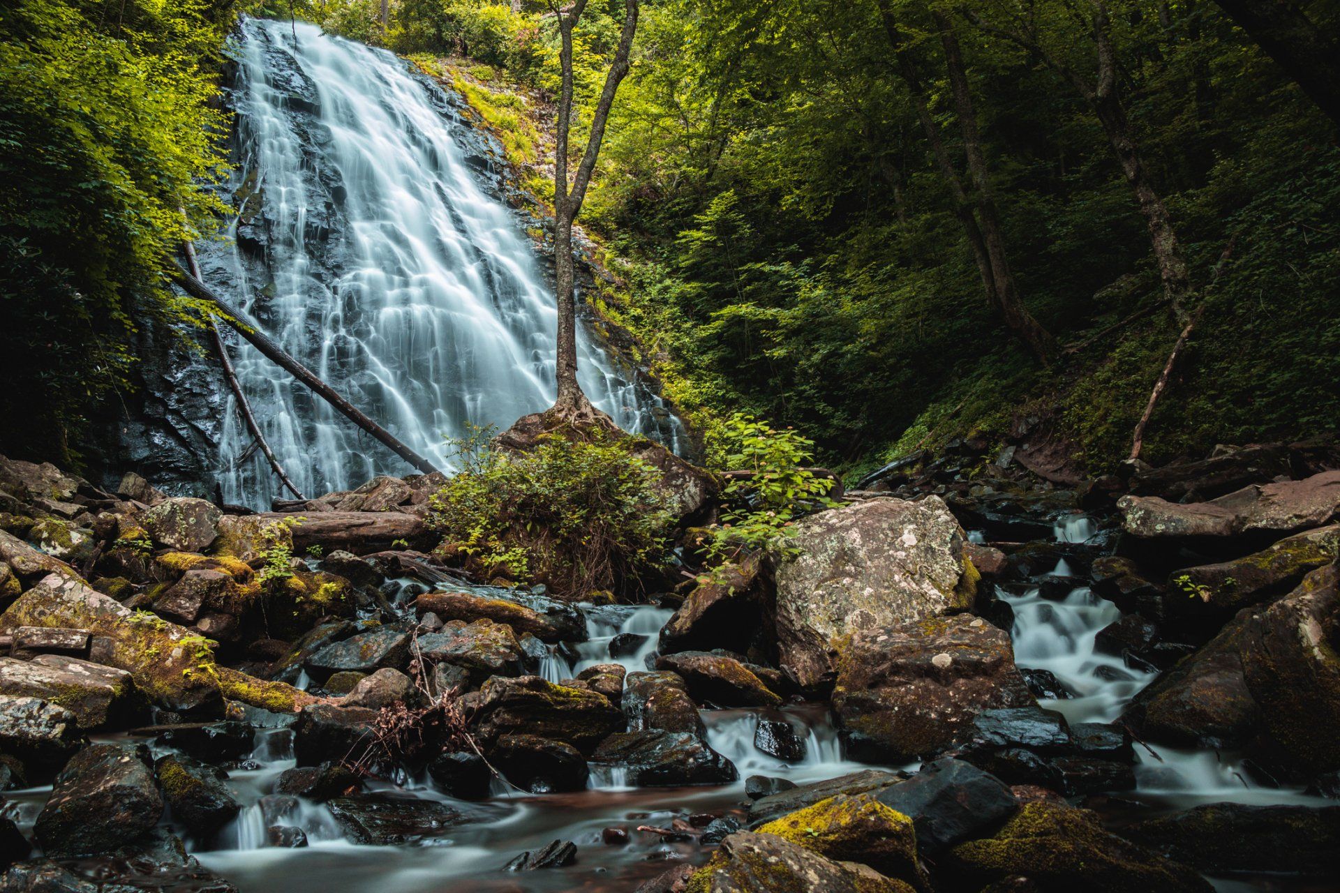
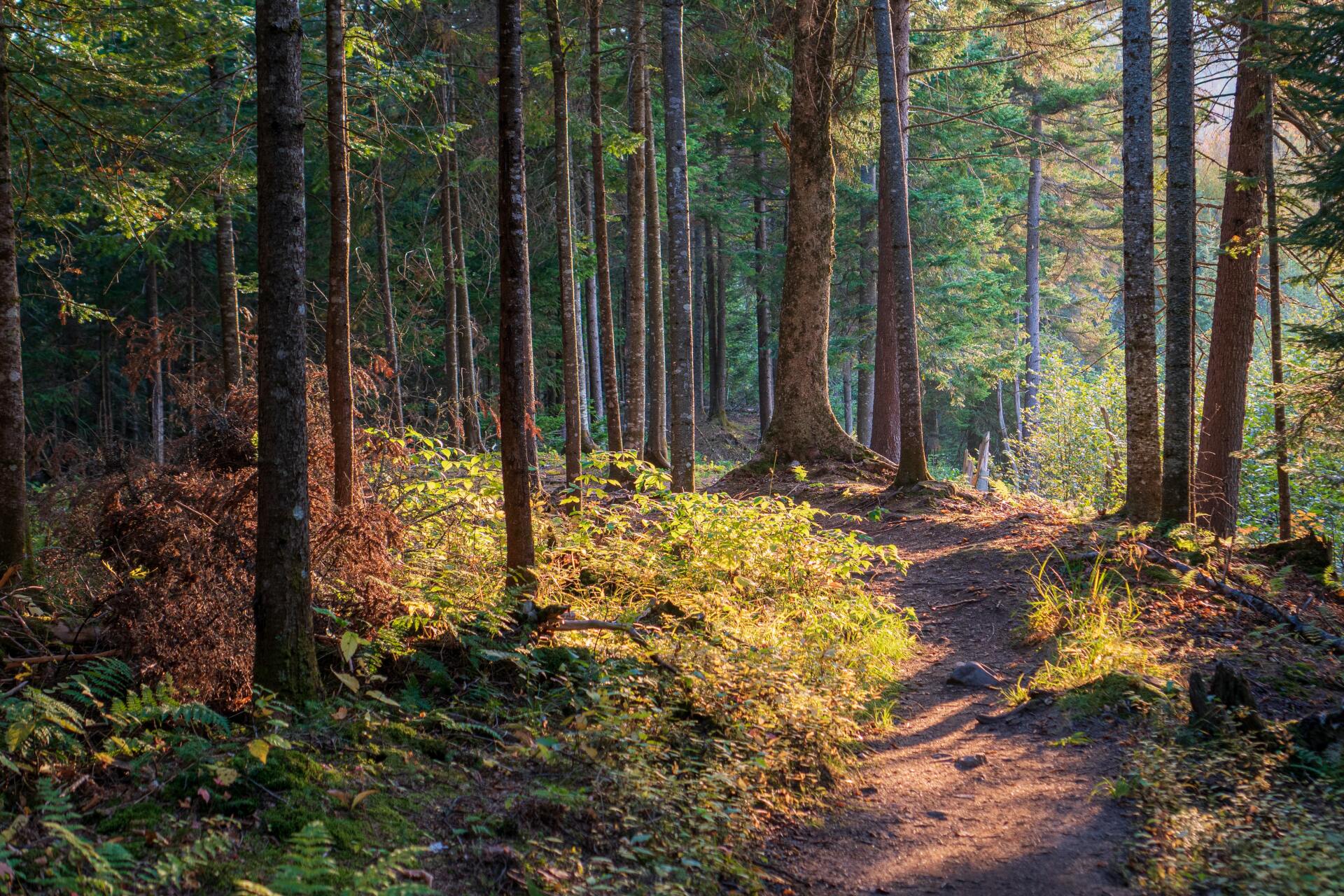
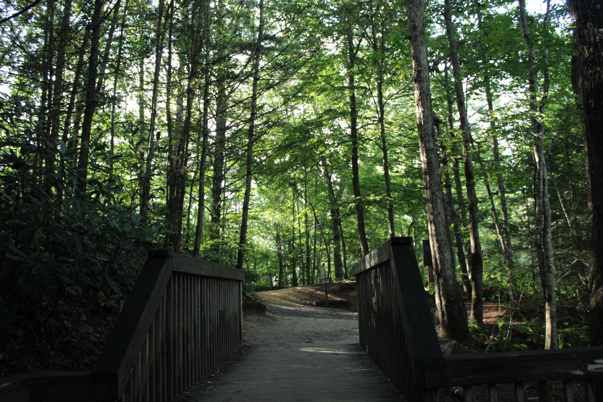
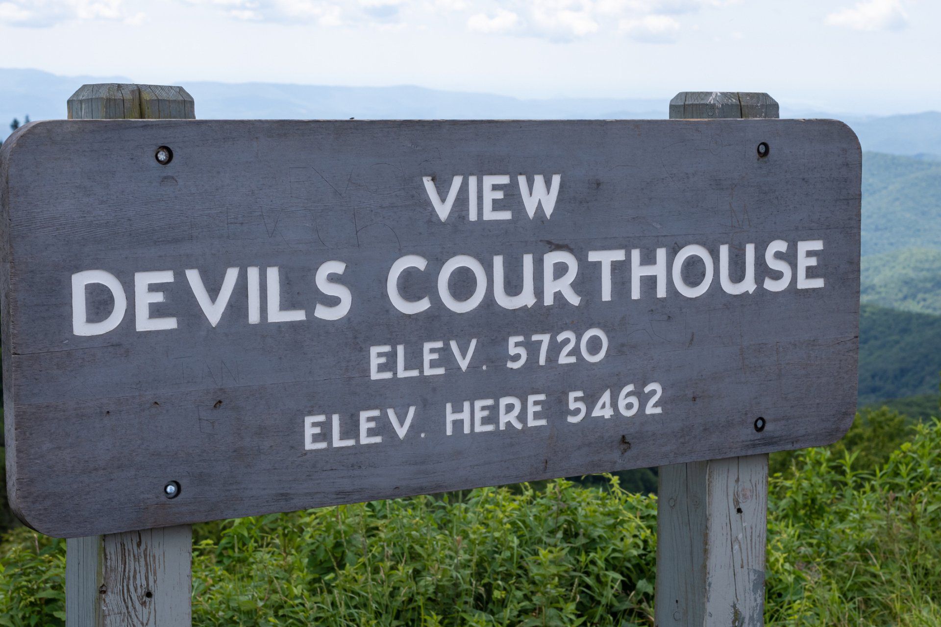
Our luxury cabin rentals are located in the home of over 100,000 acres of public lands and 250 named waterfalls framed by the beautiful Blue Ridge Mountains with access to Pisgah National Forest, Gorges State Park and DuPont State Forest, it's no wonder that Transylvania County is an outdoor lover’s paradise!  Whether you want to ascend down the side of a mountain, wind through the forest glades or step over mossy stones beside majestic waterfalls, Meraki Escape is the perfect base camp for two (or four) legged hikers!


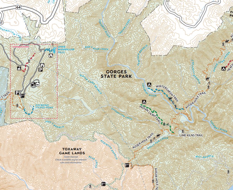
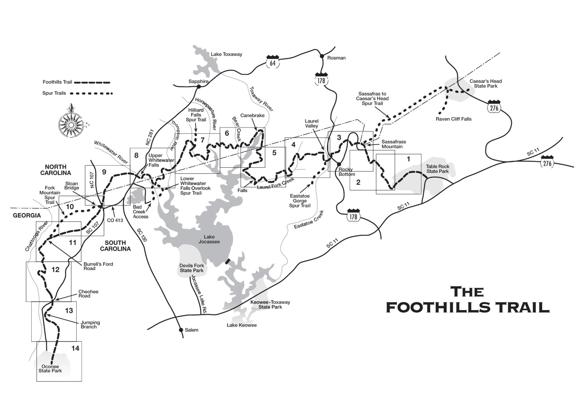
We’ve only listed a fraction of the extensive hiking opportunities in our area but know that even our shortened list can be overwhelming. Don’t stress, we’re here to help! Registered guests will receive a sample itinerary with suggested day hikes combined with other must do & see when staying at Meraki Escape.

a waterfall is surrounded by trees and rocks in the middle of a forest .

Waterfall Hikes

Our favorite hikes all lead to waterfalls and what better place to hike them than in the “Land of Waterfalls”!  With over 250 named waterfalls in Transylvania County, and a few on our property, Meraki Escape guests might have a hard time choosing where to go first. To help you decide please see our WATERFALLS page for in & out as well as loop waterfall hikes.


A breathtaking moment near a waterfall can make you forget that waterfalls can be deadly. We encourage everyone to visit Explore Brevard's  Waterfall Safety Page for tips to keep them and their pets safe.


a map showing the location of a state park .

Gorges State Park / Frozen Creek Access Area (1/2 mile from Meraki Escape)

  • Auger Hole Trail is a strenuous 7.25-mile multipurpose trail that ends on the Foothills Trail. Hikers, mountain bikers and horseback riders are allowed. Hikers get their feet wet crossing two river fords. Hikers can hop off the Auger Hole Trail and follow Chestnut Mountain Road to the Grassy Ridge parking area where they can take one of the many waterfalls trails (Rainbow Falls, Turtleback Falls).
  • The 0.60 Lime Kiln Trail is a short loop trail off of the Auger Hole Trail that will lead you down to the abandoned lime kilns. Settlers mined marble along Bearwallow Creek not too far from where it empties into the Toxaway River. Marble is metamorphosed limestone. They burned the marble in kilns to make quicklime, which they used for mortar, plaster, whitewash, and fertilizer. The kilns along this trail were used in the late 1800s and early 1900s. Although Lower Bearwallow Falls is close by, the Lime Kiln trail does not provide access.
  • Cane Brake Trail is a strenuous 5-mile trail that ends at Lake Jocassee and the Foothills Trail.
a woman with a backpack is standing in front of a waterfall

An elevation that rises 2,000 feet in only four miles, combined with rainfall in excess of 80 inches per year, creates a temperate rain forest and supports a collection plunging waterfalls, rugged river gorges, sheer rock walls and one of the greatest concentrations of rare and unique species in the eastern US. Gorges State Park offers 13 great hiking, biking, running, and horse trails starting from the Grassy Ridge Access entrance off of Hwy 281 South, in Sapphire as well as the Frozen Creek Access Area 1/2 mile from Meraki Escape.

a black and white map of the foothills trail

Located in Upstate South Carolina and Western North Carolina, the trail runs 6.7 of its 76 miles through the Gorges State Park. There are 14 sections running from Oconee State Park to Caeser’s Head State Park (via Spur Trails) passing through Whitewater Falls (sections 8 & 9), Lake Jacosee, Horsepasture River, Toxaway River and more. The trail offers adventures of every length and difficulty. (Map)

the sun is shining through the trees on a path in the woods .

8.8-10 mile round trip, Loop with out-and-back extensions. “This is a large loop with a wide variety of main attractions. The trails will take you past lazy, meandering streams with clean white sandbars, yet you'll discover 5 major waterfalls as well. You'll explore the unusual, flat-bottomed, high-elevation valley and 300-foot high granite domes standing guard over it. Sheer cliffs offer great views of the unique area. Carnivorous plants grow among thick blankets of sphagnum moss, and rare and endangered species exist in the moist spray-cliff communities and on the dry, windy granitic domes as well. Be sure to bring your camera on this long hike! “


Guided Hike with White Dot Adventures 

Crafted for Meraki Escape Guests.  Experience a private hike in one of the most spectacular outdoor destinations in the southeast, Panthertown Valley.  Private waterfalls hikes and hikes in Gorges, Pisgah and Dupont are also available.  Choose from half or full day outings, or request a custom package catered to your abilities. Snacks and water are included with all tours, and most are led by Brendon Voelker, the owner and founder of White Dot Adventures. His excursions have been featured in the Smoky Mountain News, Blue Ridge Outdoors Magazine, and his writing has been published across countless platforms including the Laurel Magazine.  Just add to your cart when booking!


a wooden bridge in the middle of a forest

There are over 100 amazing hikes in the Brevard area of Pisgah National Forest. Easy to Moderate, Dog Friendly, Mountain Biking, Bird Watching, WATERFALLS, wildflowers and more. We favor the AllTrails APP or Webpage for planning hikes in Pisgah Forest.

a person is walking on a log in the woods .

There are more than 53 great hiking trails, biking trails, running trails and more in DuPont Forest. Easy to strenuous, trails range from 104 to 1,679 feet in elevation gain… whatever you have planned for the day, you can find the perfect trail for your next trip to DuPont State Recreational Forest.

a woman with a backpack is walking through a forest .

A granitic gneiss outcropping atop the dramatic Blue Ridge Escarpment gives Caesars Head State Park its name. The park offers spectacular views that extends into North Carolina and Georgia and offers 60 miles of trails. Located on a 0.03 mile paved path from the Caesars Head Visitor Center is the Caesars Head Overlook that boasts a panoramic view from 3200 feet where you can see Table Rock, Sassafras Mt, the Dismal Forest, and even Paris Mountain. Continue on the trail to Devil’s Kitchen. According to local lore, this narrow passageway through two large rocks was accidently created by the devil himself.

a wooden sign says view devils courthouse elev 5720 elev here 5462

Between the Brevard / Meraki Escape Access Points MP411.8 and MP423.2 are 3 spectacular hikes. Milepost 420.2, Black Balsam Knob and Sam Knob hike across bald mountains above 6,000 feet elevation for sweeping vistas and a must see Milepost 422.4 Devils Courthouse offers a 360-degree view. 

a person is walking a dog on a path in the woods .

Meraki Escape's Triple Creek Trail

Meraki Escape’s Triple Creek Trail starts at our dog & bike washing station.  A descending hike takes guests along a few switch backs before they reach the bottom of the mountain where the trail connects to Meraki Lane.  This section of the trail meanders along the main creek, past all 3 waterfalls and back up to the cabins.  The trail is moderate and hikers are advised to hike at their own risk.

Share by: